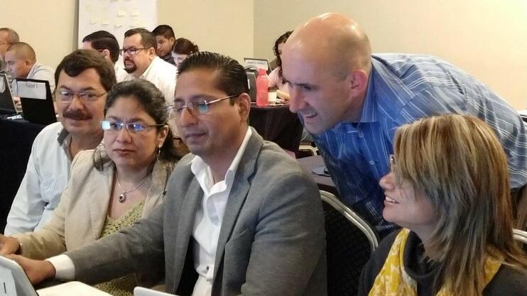
LSTM staff have recently returned from delivering a successful, week-long, training workshop in geographic data skills for operational staff in El Salvador.
This course was led by LSTM researcher Andy South assisted by Lancaster/LSTM Doctoral Training Program student Max Eyre. It built on course development by PI Sophie Dunkley, along with Michelle Stanton and Tiago Canelas. 23 local staff participated from the ministries of health and associated organisations from eight Central American countries (Guatemala, El Salvador, Honduras, Nicaragua, Costa Rica, Panama, Belize, and The Dominican Republic).
It was a part of the GIVeS – Geographic Information for Vector Surveillance program that improves capacity in Geographic Information Systems (GIS) for disease vector surveillance, by developing and delivering accessible training courses targeted at operational staff. GIVeS is a partnership between Emory University’s Center for Humanitarian Emergencies, LSTM, and the Insecticide Resistance and Vector Control team of the U.S. Center for Disease Control and Prevention (CDC). In Central America, the course was supported by Comisca (The Council of Health Ministries of Central America) who work on the identification and prioritization of regional health problems and solutions. It also came at an opportune time given ongoing Dengue epidemics in the region.

GIVeS has now provided more than 200 person weeks of training to staff from 33 countries. Two months ago Gives collaborated with the PIIVec partnership to deliver geographic data training in Malawi. The El Salvador course was a second level offering that aimed to develop robust competencies in collecting, manipulating and presenting geographic data. Resources from first-level courses are available on the GiVeS webpage and the second level resources will be added to these soon.
Participants were enthusiastic :
“This has been a very useful course and I look forward to putting it into practice in my own country.”
“Thanks for great interactive course with high quality teaching … will be of great use in understanding where in country there are more issues but also for building the evidence base in a more scientific way.”
“This is a great group. We should stay in contact to share our experiences in mapping but also epidemiology and entomology.”
Dr South said: “For me, one of the great things about these courses is that we are teaching operational staff to use flexible, open-source tools that allow them to do more in their daily work. We have seen repeated examples where our teaching is put into practice to address local disease problems.”
Max Eyre added: "It was really rewarding that in the space of a week, most of the group went from using Excel spreadsheets to making maps of a good quality that they felt would both aid their work and influence decision-makers.”
The team will be training again in Trinidad in less than a month and are looking for avenues to do more of this work.